Slow Streets Project
Streets in Malta are mostly dedicated for vehicles, including local streets which should encourage a greater pedestrian activity. Vehicles also travel at relatively high speeds, causing safety concerns for residents and other street users
At the same time, the average width of pavements is, at best, 1m – too narrow to allow two people to pass each other comfortably, or for wheelchair users to be able to navigate along a pavement, or even for an individual to pass by with a stroller. As a result, people are forced to be in close proximity with passing vehicles, risking walking, running, scooting, or cycling in the street next to speeding cars. This is a street safety issue, as well as a public health issue, in the light of the new social distancing guidelines.
Former Mayor of Curitiba
Brazil, Winner of the Global Sustainable City Award
Who are Slow Streets for?
At the heart of Slow Streets lies the local community and the need for better well- being for all residents. The ultimate objective is to make streets more welcoming and accessible to people of all ages, who want to travel on foot, by bicycle, wheelchair, scooter, or skateboard. In particular, there is special consideration for the needs of the elderly and physically disabled.
How do Slow Streets work
The Slow Streets programme is designed to limit through traffic on certain residential streets so as to allow such streets to be used more as shared spaces. ‘Through traffic’ is vehicular traffic which passes through a particular locality or area, rather than stopping there, solely in order to arrive at another destination.
Simple tools such as signage, floor markings and cones will be used to slow down speeds and block roads, either temporarily or permanently, to improve safety for people who want to walk or cycle. This type of intervention is commonly referred to as ‘tactical urbanism’. Access to private driveways/ garages and loading and unloading of goods will be maintained for residents and businesses respectively, with better management schemes, as well as access for emergency and service vehicles as required.
Different degrees of interventions are subsequently proposed according to findings from comprehensive site analyses and the development of a vision for each street as part of a wider, more extensive, network.
What is the Slow Streets initiative?
Slow Streets is a pioneering initiative in Malta and Gozo geared towards giving back streets to the people rather than cars, focusing primarily on residents’ wellbeing. The Local Councils’ Association, in partnership with Transport Malta and the Planning Authority, is collaborating on this action plan in order to give priority to pedestrians and cyclists by promoting walking, cycling and better accessibility to public transport networks. These new strategies will plan to ensure that mobility within localities is safe, sustainable, healthy and efficient, in addition to providing more public open space that contributes to an elevated quality of life.
The initiative focuses on strategies of traffic calming and management. In addition, each Local Council will study the degree of pedestrianisation it should implement according to the locality’s street network and the needs of its residents, whether temporarily or permanently. Slow Streets provides residents with an opportunity to experience their neighbourhoods in a new way, as a number of safe walking corridors will connect civic landmarks, medical facilities and other important services. This includes linking cycling priority routes and temporarily designated streets converted into creative play areas for children to enjoy safely.
In Malta, streets are the primary public spaces, used daily by everyone. In order to improve the liveability of our localities, therefore, we need to start from our streets. Having pedestrian-friendly streets implies greater, equitable access to the outdoors, active transportation, opportunities to exercise, and the support of both physical and mental health.
Slow Streets Network
The strategies of Slow Streets are based on this important concept, wherein local streets become primarily focused for local resident access and services, as opposed to through traffic. Within these strategies, access to public transportation is always being permitted, even within those streets which have been selected to have no (or very limited) access for vehicles, so as to further encourage the public to use buses rather than their private cars.
The main outcome of the desktop analysis is the selection of potential Slow Streets, which together make up a comprehensive network. The selection of streets to be included within this network comprises a critical stage, as it sets the overall strategic vision for the locality. The selected streets undergo further in-depth ‘micro’ analysis, wherein on-site observations are carried out at different times of day and for different days of the week, in order to ensure that the selected strategy may be carried out successfully. These observations include:
pedestrian connectivity (understanding the location and frequency of crossings and pavement continuity);
other connections, such as stairs or informal/unsurfaced paths;
solar exposure of the street network (and the amount of shade throughout the day);
the presence of green or urban open pockets, including front gardens;
the availability of street furniture;
ground floor use (for instance, whether commercial or residential);
the amount and frequency of garage doors and the presence of reserved parking;
social behaviour and activity within the urban spaces.
Pavements and roads are further measured on site in order to sketch an accurate section for each of the selected streets. This exercise is crucial for determining the possible intervention within each street, based on the available road space, and taking into account both the activities and characteristics of the street.
All the data is collated and the proposed network is analysed with all the information at hand. The project team goes through this analysis and establishes a vision for the locality – with a prime objective being that of resolving existing problems caused by through traffic and improving the connections to important public spaces – following which, individual street and space interventions are discussed and agreed upon.
The strategy is finally concluded once it may be established that the individual interventions are able to coexist seamlessly, without creating any unwanted repercussions and while further considering potential extensions with neighbouring localities.
Għajnsielem

Għajnsielem is a large, historic village in the south-eastern area of Gozo, Malta’s sister island, and includes the…
Għarb

The small village of Għarb lies at the western part of Gozo and is characterised by its residential character and quiet nature.
Gzira
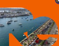
Gzira encompasses two large public spaces that act as important nodes, the Gzira Gardens (Gnien il-Kunsill ta’ l-Ewropa…
Msida

What currently characterises the locality of Msida is the disconnection between different areas…
Safi

Ħal Safi is a small locality located in the Southern region of Malta, close to Malta International Airport…
Sliema
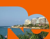
Sliema is a densely populated locality and a popular leisure destination for locals and foreigners alike…
St Julian's
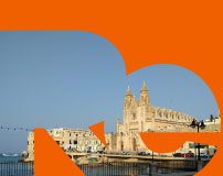
St Julian’s is a diverse yet challenging locality, since it is divided into a number of different neighbourhoods …
Ta' Xbiex
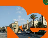
Ta Xbiex is a small locality in the Northern Harbour area, known for having several embassies, insurance office buildings
Żurrieq

A large locality located in the southernmost region of Malta, Żurrieq is one of the oldest urban settlements on…
Munxar

Munxar is a small village within a larger territory located along the south-west edge of Gozo, which is characterised…
Birkirkara

Birkirkara is a large locality in the centre of the island of Malta with a mixed population comprising both young…
Qala

Qala is a large locality in the eastern edge of Gozo, which is characterised by large stretches of agricultural land…
Swieqi

Swieqi is a large residential locality in the Northern region of Malta, with a mixed population including local…
Naxxar

Naxxar is a large residential locality in the Northern region of Malta, with a mixed population including local and…
Fgura

Fgura is a recently developed residential area that expanded in all directions, to touch Bormla, Zabbar…
Floriana
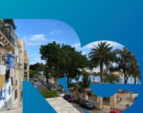
The small town of Floriana, boasts the largest square in Malta, the largest number of public gardens…
Santa Venera

Santa Venera is a densely populated locality with its main residential areas broken up by a number of large and busy…
Żabbar

Żabbar is one of the oldest and largest villages in Malta. However, despite its size, the town still retains its village-like…
Hamrun
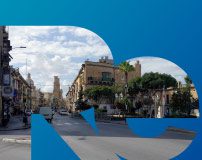
Hamrun is a densely populated locality and a frequently visited destination for shopping, business activities…
Siġġiewi

Siġġiewi is a relatively large and densely populated town with a large number of centuries old churches, chapels…
Żejtun
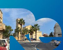
Zejtun is a large and densely populated town with a large number of centuries old churches, chapels, buildings…
Dingli

Dingli is a small village located in the Northern Region of Malta and enjoys a small population, mostly comprising local families.
Mqabba

Mqabba is a small traditional village located in the southern area of Malta, surrounded by other small localities…
Isla

Isla is a compact and densely populated town located on a peninsula in the Grand Harbour, with beautiful traditional…
Kalkara

Kalkara is a compact and densely populated town organised around Kalkara Creek, with a number of traditional…
Rabat Malta

Rabat is a large and densely populated town with a large number of centuries old churches, chapels, buildings…
Victoria

Victoria, always known as ‘Rabat’, is the capital city of Gozo, Malta’s sister island. It is situated on high land in the centre
Mgarr

Mġarr is a large locality situated at the North-western coast of Malta. The locality is predominantly…
Attard

Attard is a central locality in Malta, predominantly residential in nature. The locality contains various open recreational…
Birgu
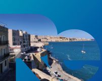
Birgu, also known as Citta’ Vittoriosa, is one of the three cities situated along the Grand Harbour, together with…
Marsa

Marsa is one of the larger localities of Malta, situated within the south eastern portion of the island and wrapping…
Xewkija

Xewkija is one of the oldest localities in the southern area of Gozo with a population of around 3,300…
Xagħra

Xagħra is one of the oldest towns on Malta’s sister island, Gozo, located in its eastern area and surrounded by other…
Ħal Għargħur

Ħal Għargħur is a small locality situated in the North-eastern region of Malta. The locality is predominantly…
Bormla
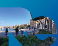
Bormla, also known as Citta’ Cospicua, is one of the three cities situated along the eastern side of the Grand Harbour…
Tarxien

Tarxien is a small locality in the South Eastern region of Malta with a mixed population demographic, including…